To get there we took the Mahican Mohawk trail towards upper meadow.
The trail in park is part of the original trail that natives used to travel through this area. Or at least that is what the trails creators think. I wonder about some of the current route and reasoning behind the location. But that is for another blog post.
Upper meadow is a great place and very impressive. Lower meadow is just as expansive. They were both part of the Wheeler farm. We will do some further investigating to find out about Mr Wheelers neighbors the Jackson family. We heard from the ranger that those were the two farms that made up this area. Tough place to live in the late 1700's
Well it didn't take us long to find our objective:
Rough location- Nope no UTM! Put your detective hat on.
We had a quick lunch and noticed the clouds pouring in. Felt like snow was on the way.
As you can see the rocks are quite large in this area
We headed down to the river and through the red pine forest.
As we walked along we heard a screech from some kind of bird. We thought it was a hawk or owl. It called out twice with quite long and strange calls.
We the saw this and saw an eagle flying up through the trees.
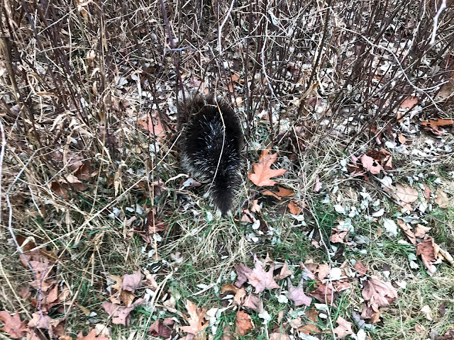
It was a baby porky! Slowly making and escape.
Then Theresa saw this under an old apple tree.
Did junior fall out of the tree? Once we got home we googled eagles and porkies. Yup an eagle will attack a porky. With often deadly results ( for the eagle). Porky quills harbor lots of nasty bacteria.
Well maybe that is what happened. We will return in a few days to see if junior had injuries from the eagle. He might have succumbed to them and not have gone far. Stay tuned.
On the way out I spotted and odd rock by the river. Obviously man-made.
No idea what that was all about. More mysteries to solve.
We headed down towards the river in hope of connecting to an old road I remembered. You can see the roads at the tip of the area in the photo below. Basically we wanted follow the river back up to the houses in the white area- the ranger station. We were at the intersection of the rivers near the 210 mark.
We found the old dump. Lots of booze bottles!
We tried but could not make it through that section. We asked the ranger if the roads did connect at one time and he said yes.We encountered a landslide that wiped out the road and caused a huge slide into the river. Hurricane Irene was the cause of that damage. We had snowshoed that road years prior to that. Oh well.
Next time we will investigate the Jackson farm.


No comments:
Post a Comment